Well, we intended to pickup another 3 caches today on our return trip. Alas, mother nature decided to water the lawn and seems to have forgotten to turn off the sprinklers. So, we just came on home. For some time now I've been wanting a better way to track where we've been and how we're doing on our journey. So....I turned to my good friend Google to create a map. It took a bit of grunt labor to build it, perhaps I'll eventually move it all into a database to build the KML file for me automatically using Geocaching.com's API to gather details on which caches we've been to and such. But until then, here you go.
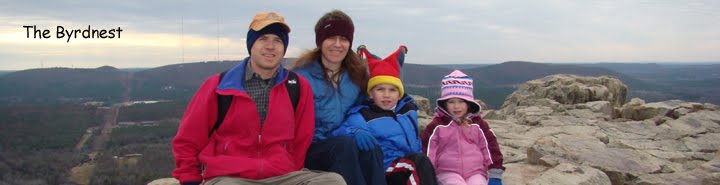
Oh, and I updated the template for the blog. Good, bad? I know I need a new header photo, but that's gonna have to wait until our annual trek up Pinnacle for New Year's (assuming we don't get iced out this year).
Direct Links to the posts:
Spring Break Part Two - 2017/03/27
On the road again - 2017/03/20
4 days, 2.5 tanks of gas, 834 miles, 10 State Parks, and 10 caches
Closing in on half way - 2016/08/06
Mark another couple off the list - 2016/03/21
New Years Trip - 2016/01/02
On the Road Again - 2015/11/24
Another Weekend More Caches - 2015/09/07
Caching the State Parks - 2015/08/23
My various ramblings as I try to keep everyone upto date on the family.
Sunday, November 29, 2015
Tuesday, November 24, 2015
On the Road Again
School's out for Thanksgiving so must be time to visit more State Parks and grab a few more geocaches. October was pretty busy so we didn't manage to collect any State Park Caches but now we should have a bit of time.
This trip it was time to hit a cluster of parks in North West Arkansas, and to visit the new niece/cousin.
First up was Lake Fort Smith State Park. This is a new old park. Back in 2002 they closed the old park to allow for the expansion of Lake Fort Smith. They packed up and moved 2 miles north. We hiked a bit of the Ozark Highland's Trail to get to the cache.

Next up was Devil's Den State Park, 9 miles as the crow flies, 32 as the car drives. We've camped at this park before, it's a nice place to go "off the grid" since it's now in a hole that cell signals don't get to. It's also unique in that it has both sandstone and limestone caves. They are all closed right now to protect their resident bats from the White Nose Syndrome but there's still plenty of trails to hike.

The last stop was Prairie Grove Battlefield State Park, one of many Civil War parks in the State. We learned a bit of history. The park was flying 2 flags, the current US flag as well as another flag that took google to determine what was. It was the official flag of the Confederate States. Most people assume the Confederate Battle Flag was their flag, it wasn't. It has 3 stripes (2 red, 1 white), a field of blue, and a circle of stars. Lots more information here.
.svg/270px-Flag_of_the_Confederate_States_of_America_(1861-1863).svg.png)

So, for those keeping score we've collected 11 of the 52. Maybe we'll manage to grab another 3 next weekend to keep our streak alive.
This trip it was time to hit a cluster of parks in North West Arkansas, and to visit the new niece/cousin.
First up was Lake Fort Smith State Park. This is a new old park. Back in 2002 they closed the old park to allow for the expansion of Lake Fort Smith. They packed up and moved 2 miles north. We hiked a bit of the Ozark Highland's Trail to get to the cache.

Next up was Devil's Den State Park, 9 miles as the crow flies, 32 as the car drives. We've camped at this park before, it's a nice place to go "off the grid" since it's now in a hole that cell signals don't get to. It's also unique in that it has both sandstone and limestone caves. They are all closed right now to protect their resident bats from the White Nose Syndrome but there's still plenty of trails to hike.

The last stop was Prairie Grove Battlefield State Park, one of many Civil War parks in the State. We learned a bit of history. The park was flying 2 flags, the current US flag as well as another flag that took google to determine what was. It was the official flag of the Confederate States. Most people assume the Confederate Battle Flag was their flag, it wasn't. It has 3 stripes (2 red, 1 white), a field of blue, and a circle of stars. Lots more information here.

Monday, September 07, 2015
Another Weekend, more caches
What do you do on Labor Day? You head out to find more caches. In-laws in town? Bring them along. 250 miles and 10 hours later we have another 3 Park Caches in our collection (had to skip the 4th one on the list due to time).
First we headed west on Highway 10 to Peron and headed up the mountain to Petit Jean State Park. We've already been there several times so it was a quick stop to grab the cache.

We headed out the other side of the park on our way to Havana (Arkansas, not Cuba) to head north (and up, you gain almost 2000 vertical feet) to Mount Magazine State Park. We've been here before but the cache was a bit down one of the trails. After tracking it down (which required a smidge of bushwhacking) we went ahead and completed the loop. Once we returned to the cars we had a nice picnic lunch before heading out for our next destination.

Next up was Mount Nebo State Park. After a brief stop at the visitor center to refill water, use the restrooms, and pickup an ice cream treat (thanks Opa) we headed to the trailhead for the Bench Trail. We quickly picked up the cache and headed on 'round the mountain. We had hopes of scenic views as we traversed the 4 mile trail but opportunities were far and few between. They became more numerous once we got back on the North side of the mountain.

We had to cut our trip short, not making it back to our cars to make it to Lake Dardanelle State Park before the visitor center closed. Since we want to do more than just "grab the cache" we'll stop back by next time we're passing by (probably Thanksgiving).
So that gets us to 8 of 52.
First we headed west on Highway 10 to Peron and headed up the mountain to Petit Jean State Park. We've already been there several times so it was a quick stop to grab the cache.


Next up was Mount Nebo State Park. After a brief stop at the visitor center to refill water, use the restrooms, and pickup an ice cream treat (thanks Opa) we headed to the trailhead for the Bench Trail. We quickly picked up the cache and headed on 'round the mountain. We had hopes of scenic views as we traversed the 4 mile trail but opportunities were far and few between. They became more numerous once we got back on the North side of the mountain.

We had to cut our trip short, not making it back to our cars to make it to Lake Dardanelle State Park before the visitor center closed. Since we want to do more than just "grab the cache" we'll stop back by next time we're passing by (probably Thanksgiving).
So that gets us to 8 of 52.
Sunday, August 23, 2015
Caching the State Parks
Been a while since I've put anything on here been doing most of my "sharing" on Facebook. But, this medium is more conducive for this kind of thing.
So back in 2008 the Arkansas State Parks created a Geocaching series to encourage folks to visit all of the state parks. The general gist is, find a cache in each park with a clue to the whereabouts of the final cache. Well, back then the kids were too young to really do much with it so I ignored it. A couple of weeks ago they "re-announced it" so we decided to have a go at it.
We decided that we should actually visit each Park (previous visits counted) instead of just "cache and dash". The whole family also have to have visited the park.
The next Saturday we headed over to our local state park (Pinnacle Mountain State Park) and eagle eyed Emily quickly found the cache for us. 1 down, 51 to go. I forgot that I've been "collecting" pictures of the State Park signs. Fortunately it's close so I'll swing over there in the next couple of weeks to grab a picture of it. I'd also like to "collect" some of the caches that are located there.
This weekend we thought we'd snag a few more. We started off at Plantation Agricultural Museum in Scott. Learned a bit about Cotton Ginning and such.

Then it was on down the road to Toltec Mounds Agricultural State Park. Watched an interesting 10 minute movie about the history of the site. Started to walk one of the trails but were chased off by an approaching storm.

Then we headed east to the Louisiana Purchase Historic State Park (a nice long drive). After 15-20 minutes of fighting the swarming mosquitoes (it is located in the middle of a swamp) we failed to find the cache, quite frustrating after the drive. Storms were looming, it was getting dark, and the mosquitoes were swarming. So, we headed home.

Today, we headed north to Woolly Hollow, a nice jaunt down a mountain biking trail led to a wooden bridge. Then we had to do a bit of searching to find it. Found a suspicious pile of sticks under a tree, bingo.

Eli and I headed back to Louisiana Purchase Historic State Park armed with bug spray and determination to find the cache. After searching for 15 minutes and forcing my phone to "relocate" itself I set my phone down to within a foot of the cache. Continued searching with no luck. Was ready to give up, turned around and said "hey Eli, here it is". Success.
So, we're 5 for 5. 47 plus the final one to go. The rest are going to be a bit longer slog from the house. We've visited 4 more (Crater of Diamonds State Park, Devil's Den State Park, Mount Magazine State Park, and Petit Jean State Park), as a family so those will be quick "cache and dash" visits.
Some of the ones we need to visit are 30 minute visit kind of places with no camping, etc. Others are bigger with lots to do. So, hopefully over the course of the next year we can visit the rest. Use some of the bigger parks as a "basecamp" to go visit some of the smaller ones. Should be a good way to see the whole state.
Subscribe to:
Posts (Atom)