Tuesday, July 03, 2018

2018 Great Western Trip

Back when Emily was in 4th grade the National Park Service started a program where you could get a pass to allow their whole family in for free (entrance fees are fairly expensive).  We didn't have time to plan and take advantage of it but we knew we wanted to take the kids out west.  So, we started planning a trip.  Last July we booked a cabin on the North Rim of the Grand Canyon and a room on the South Rim of the Grand Canyon (bookings open up July 1 of every year and fill up quickly).  We then started filling in the blanks.

Alicia's parents have been taking advantage of being retired and having purchased senior passes before their price increased 8x.  We invited them to join us on our trek.

So, where all did we go?  We started with Mesa Verde in Colorado, moved north to Arches in Utah, jumped to the Western side of Utah to visit Bryce Canyon and Zion (skipping Canyonlands and Capital Reef in the process).  We then moved down into Arizona to visit both rims of the Grand Canyon, and lastly to New Mexico for Carlsbad Canyon.

All told it was about 60 hours in the car (without stops) covering roughly 3760 miles.

We purchased an annual pass for $80.  This got us into all of the parks and got us our tour at Carlsbad Canyon for free.  If we'd paid individual entrance fees it would have been over $200, plus it's good for a year, so we're planning some additional trips.

I'll do more posts for individual parks, but for now I'm going to give a high level summary of what we did and include a few teaser photos.  The kids will chime in on the individual parks as well.

Friday, June 22
We headed out at about 4:30, after a brief stop for gas and food in Alma we pressed on towards Oklahoma City.  We stopped briefly at the Oklahoma Welcome Center (that was closed).  The kids noted that the picnic tables looked like tepees.  We finally got into our room about 10:30 right before a pretty good storm arrived.


Saturday, June 23
After grabbing breakfast at the motel we got on the road about 8:15.  We stopped at the Texas Welcome Center in Amarillo (we noticed they had rather interesting patterns in the tile in the bathrooms, and high wooden ceilings).  They also had metal animal silhouettes outside.  After a brief gas and lunch stop we headed onto Albuquerque.  The New Mexico Welcome Center was essentially at the border.  We stopped in for a bathroom break and to pickup a map.  We adjusted the car clock to self adjust since we would be traveling through several time zone changes on the trip. It was interesting to watch the landscape change, both becoming more mountainous as well as the changes in the vegetation.  It was really pretty coming into Albuquerque.  It was over 100 when we got there, we could also tell that we had gained about 5000 feet of elevation.


Sunday, June 24
Another early start so we can get to Mesa Verde.  We stopped in Durango, CO for lunch (and a WalMart stop).  It was interesting, after leaving Albuquerque we saw no signs of life for about an hour and a half.  From the welcome center to the majority park was a 20 mile drive UP to the top of the mesa.  We took the balcony house tour which involved climbing a 32-foot wooden ladder to get to the dwelling.  And 2 more 11-foot ladders to get out.  After about 5 hours at the park it was time to head on to Thompson Spring, UT where Roy and Judy had an Air B&B for the night.


Monday, June 25
We headed out early to beat the crowds to Arches.  We saw several arches: Delicate Arch - the most famous, Landscape Arch - largest in the US, Pine Tree Arch, Tunnel Arch, Double Arch, and lastly the North, South, and Turret Arches.  After about 5 hours we headed across Utah to our hotel outside of Bryce Canyon.


Tuesday, June 26
We spent the day at Bryce Canyon.  We parked outside of the park and took their free shuttle in (they have 1 parking place for every 4 cars inside the park).  We road the bus around the main portion of the park and also walked around.  We visited Sunset and Sunrise Points.  We then hiked down into the cayon on the Garden Trail (very steep).  After lunch we visited Inspiration and Bryce Points.  We road the shuttle back out to our cars and drove in to goto the back of the park where Rainbow Point @9000-feet is.  We then headed back to the motel for dinner.  We planned on coming back to catch the sunset but we timed it wrong so we missed it.  It was also a near full moon so it was hard to see any stars.


Wednesday, June 27
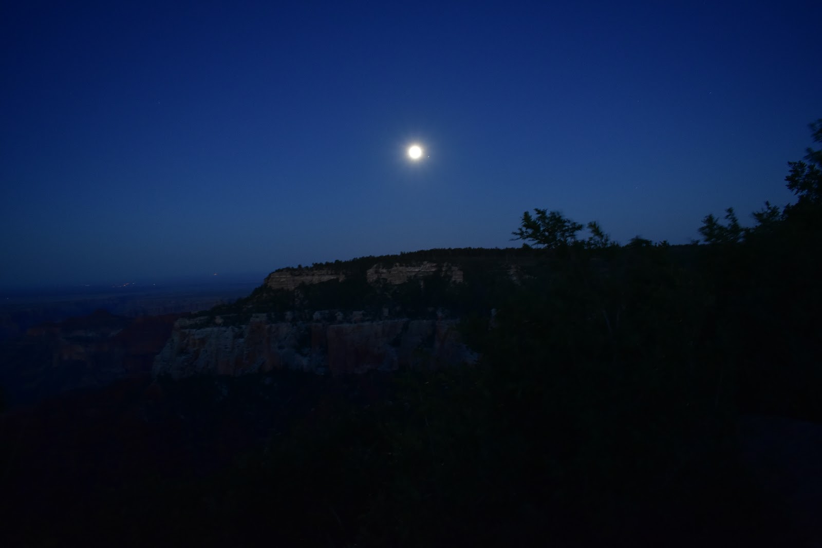
After breakfast we headed south for the North Rim of the Grand Canyon.  We planned on a brief stop at Zion but due to a miscommunication we wound up driving all the way through the park and then back out.  It was worth the detour (more on that later).  We bought lunch at the last stop before entering the Grand Canyon (The Grand Canyon General Store).  It had 2 gas pumps, one selling desel, the other selling regular.  We bought lunch from a food truck.  We saw a herd of buffalo just inside the park.  We walked around for a while, then had dinner at the Lodge.  After dinner we took a hike we'd planned on doing before dinner.  It was good we went after dinner, we managed to catch the sunset, it was beautiful.  I left the drapes open on my side of the cabin so I could see the stars, unfortunately that also meant the sun could come in early :(.


Thursday, June 28
After a quick breakfast at the saloon, we headed back out to go around to the South Rim.  It's about 1.5 hours back to the intersection where you turn east, we went by Vermillion Cliffs National Monument, crossed the Colorado, then headed back West to reenter the park at the east gate.  We stopped at the Watchtower (beautiful views), had lunch, and then started the 20 mile drive west into the main village.  We stopped at several vistas and also had to contend with construction traffic (they are rebuilding the road).  After checking into our room we took the shuttle to the visitor center.  We then took the shuttle to the far side of the village to eat dinner and walk along some of the rim trail.  After dinner we bumped into a moose eating dinner along the trail.  We tried going back to the visitor center to walk a trail to view more wildlife but it took longer for the bus to return than we expected so we just headed back to our room.  We did get some star viewing in though.


Friday, June 29
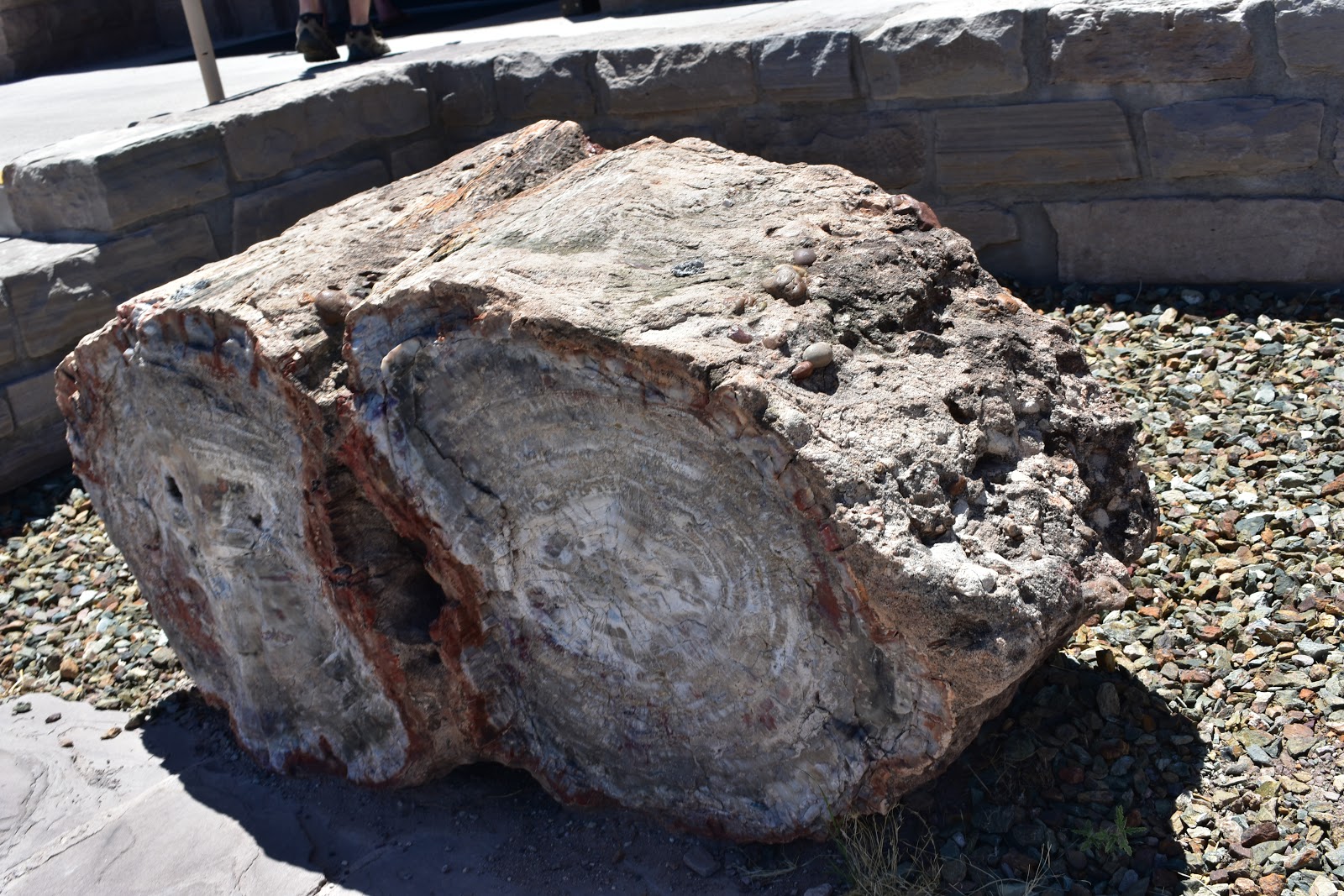
Another travel day.  The plan was to drive to Roswell, NM via Albuquerque (about a 9 hour drive).  About 1/2 way there Waze warned us about a traffic problem ahead (truck caught on fire and set grass on the side of the road on fire) and rerouted us.  This reroute took us by the Petrified Forest (so we stopped), the Very Large Array (radio telescopes), and the Smokey the Bear Historic State Park.  After 11.5 hours we finally made it to our hotel.  It was only 2 miles further than if we'd stayed on the interstate.


Saturday, June 30
A relatively short drive down to Carlsbad Caverns where we spent a couple of hours underground enjoying the 56 degree temperatures.  We all walked in via the natural entrance.  Eli didn't want to wait in line for the elevator (30 minute wait) so he and I hiked back out that way (mind you we were 750 feet under ground).  It took us about 30 minutes to get out.  Then it was onto Abileen, TX for the night.  We finally found a Sonic to get a treat at (right on the New Mexico Texas line).  There was a storm racing us for the intersection with I-20 (it won) but we saw lots of cool lightening behind the windmills.  We got ahead of the storm on I-20 and got moved into our room right before it arrived.


Sunday, July 1
We slept in a little and then got on the road home.  I knew the Dallas-Fort Worth area was large but it took us about 1.5 hours to drive across it.  We got lunch on the other side of Dallas and then started looking for another Sonic.  We stopped at the Arkansas Welcome Center in Texarkana.  We finally found a convenient Sonic in Benton.  Finally making it home around 5.

Tuesday, November 21, 2017

Closing in on the last one

I've got a full tank of gas, the kids are Nana's for the day, Alicia's at work......hummmm, the kids are tired of caching, what's a fella to do......time to hit the road.

First stop was Lake Catherine State Park.  Located on the shores of one of several lakes clustered together in Central Arkansas.  When I first got to where I thought the cache was I noticed some signs marking the trail closed due to hunting, hummmm, not good.  Then I looked down at the fuzzy jacket I was wearing, hummmm, deer colored, good thing I'm gonna be in State Parks today.  Rechecked the GPS and saw I didn't need to take that trail after all, cache acquired, time to move on.


Next stop was DeGray Lake Resort State Park.  On the way it occurred to me that I'd forgotten to grab the bagel I'd intended to eat for breakfast, swung by a Pilot that just so happened to have a Cinnabun stand inside, grabbed one of those and a thing of chocolate milk, problem solved.  Now onto the park.  One thing I realized I failed to take into consideration was that the milages between things was basically park entrance to park entrance.  I failed to take into consideration the time required to drive within the park, more on this later.  This cache was located in an interesting place at one of the swim beaches, let's just say I'm glad my arms aren't any shorter than they are.


The next target was Daisy State Park, located on the shores of Lake Greeson in Daisy, Arkansas.  Looks like a nice hidden gem of a place to come spend a weekend.


Onto Cossatot River State Park - Natural Area, I missed the turn that my GPS wanted me to take onto a Weyerhouser road to get to where the cache is, as luck would have it I wound up at the park sign that I needed to take a picture of anyway, and there was a sign pointing me towards Cossatot Falls.  Six and a half miles of gravel road later (remember how I mentioned I'd forgotten to factor in traveling to the actual caches?) I was at the falls, and quickly found the cache.  The water was down so no-one was playing in the falls, but I can see how boaters could have a lot of fun there.


Time to head back east.  Quick stop for lunch on the way to Lake Ouachita State Park, then hunting for the cache.  This was the most challenging of the ones I found today, very sneakily hidden.


I plugged today's finds into my spreadsheet and determined that my answer was indeed inside of one of the State Parks (good sign).  I headed towards it hoping to find stage one today, then the family come back another day to find the actual finally.  My luck ran out after having found 5 caches today.  I reached out to some fellow cachers who have finished the challenge to check my numbers, so far I've received confirmation that I'm off, now to see by how much.  Stay tuned, the end is near.

Sunday, October 01, 2017

Butterflies and a cache

We picked this weekend to goto Queen Winhelmina State Park because it was predicted that the Monarch butterflies would be passing through on their way south for the winter.  We did see some butterflies, lots of bikes (both human powered and gas powered).  We hiked a couple of trails (bushwhacked to fetch the park cache (that's #47 of 52), rode our bikes, hung out at camp.

I bumped into a couple of Rolla grads at the bath house last night.  Emily and I were walking up (I was wearing a UMR sweatshirt) and a guy asks "are you an alum?".  We talked for a bit, turns out he (ME'08 and his wife ArchEng'08), also lived in the Quad.  Small world.

We'd planned on stopping by another park on the way home since it was "in the neighborhood" but Eli didn't sleep well last night so we opted to just head straight home.

Had to ask where the park sign was (different road than we came in on) and snagged a picture last night.  Glad I did because since we didn't goto the other park we didn't go out that way either.

If you squint you can see a butterfly.

Speckled King Snake, we watched him until he moved on along

Gorgeous views


And of course, sign #47.

Five more parks to go.  Since we're not whitewater boaters Cossatot will probably involve hiking a trail along the river.  We can hike from the visitor's center to the cache and back (it's about 4.5 miles each way), it'll be a long hike but quite doable with daypacks.

Daisy will probably be our campground when we go see it and Cossatot.

The 3 lakes (Catherine, DeGray, and Ouachita) will probably all be done together.  Stay at 1, enjoy 1, visit the other 2 as well.

If we'd been thinking further ahead, perhaps we would have used the 4 day weekend around Columbus Day but we have other plans Friday and Saturday night.

We're getting close, I'm looking forward to finishing up.

Tuesday, May 30, 2017

And then there were 6

This weekend on the way back from a quick trip to KC for Opa's birthday we swung by Hobbs State Park - Conservation Area for another try at their cache.  If you'll recall from March of 2016 we attempted to find it but came up empty handed.  This time after reading notes from several other cachers who had found it we were successfull.  We did discover that the clue was missing though.  Talking to the friendly visitor center staff they had the clue handy "people keep walking off with it or wiping it off of the container".

I've been holding onto this sign photo for over a year, so Woohoo, I finally get to post it.


So that's park #46 of 52.  At least 1 is going to have to wait until the fall butterfly migration.  The kids are a bit burned out on collecting caches right now too.  Collecting 13 over 2 weekends of Spring Break may have been a bit much.  Especially since there was considerable distance between some of them which meant many hours in the car.  Perhaps we'll be finished by the end of the year.

Monday, March 27, 2017

Spring Break - part two

There's a saying in Arkansas.  If you have outdoor plans in the Spring, you'd better have an alternative ready.

We'd planned on another weekend of camping.  Mother Nature decided she needed to water the yard some more and blow some leaves, so we camped in our house Friday night to avoid the storms rolling through.  Saturday morning we awoke to a beautiful (unpollinated) morning.  We headed to the extreme Southwest corner of the state (south of Bradley) to Conway Cemetery State Park.  Resting place of Governor Conway (and his family), the First Governor of Arkansas.


We headed north to Logoly State Park.  It gets it's odd name by taking the 1st 2 letters of the last names of the 3 families (Longinos, Goodes, and Lyles) who owned the land when it was leased as a Boy Scout camp before eventually being purchased by the Nature Conservancy.  A nice quiet park.  I did make a navigational error when scouting out where the cache was which took us a bit out of our way.


Next up was Poison Springs Battleground State Park, first in the Red River Campaign.  The cache was a good 100' away from where it was supposed to be and had recently been "cleaned up and fixed".  Unfortunately, the park series clues weren't put back, so I'm working on obtaining those from other sources.


Last stop of the day was our campground for the evening, White Oak Lake State Park.  Beautiful place to spend the evening (once the generator next door was turned off), nice trails to walk on, a lake to play on in warmer weather.  Unfortunately, this cache suffered from the same "clean up and fixup" as the last one, sigh.


Sunday morning we awoke to a nice foggy morning on the lake.  After breaking camp and eating breakfast we headed South East again to Millwood State Park.  This lake is the water source for Texarkana and home to lots of large bass (or so the brochure says).  We had an enjoyable stroll and picnic lunch on the two trails by the lake.


Historic Washington State Park was our next target.  Capital of Arkansas for a couple of years after the Union troops captured Little Rock.  A quaint little town.


A quick stop by Crater of Diamonds State Park to grab that cache and stickers for the kids' trunks.  The hiding spot for the cache was one of the more ingenious I've seen.


And then it was time to head the rest of the way home.

So, for the weekend that gives us:
#39 - Conway Cemetery
#40 - Logoly State Park
#41 - Poison Springs Battleground State Park
#42 - White Oak Lake State Park
#43 - Millwood State Park
#44 - Historic Washington State Park
#45 - Crater of Diamonds State Park

45 of 52, 87% getting close.  It was a successful set of Spring Break caching trips, 13 caches across the two weekends (still gotta track down the clues for 2 of those).


Monday, March 20, 2017

On the road again

It's Spring Break in Arkansas which must mean it's time to get back to geocaching.  This weekend took us to 6 parks via 450 miles or so of road.  For those who don't know, South Arkansas is timber country.  We saw LOTS and LOTS of timber.

The weekend started with a drive down to Cane Creek State Park.  After briefly confusing the ranger because "our name wasn't on his list" we got moved into our campsite for the weekend.  One thing we discovered is either there was a family reunion of sorts going on, or the folks around us knew each other from camping/fishing.

Saturday morning after packing a sack lunch we started our quest by obtaining the park's official cache.  We then headed off on a leisurely jaunt through the woods to one of the 3 swinging bridges in the park.  That was about a 6-7 mile stroll, the kids were pretty zonked by the time we finished.  We decided a drive in the car to another park to allow some rest time was in order.  So, we headed on over to Marks' Mills Battleground State Park (one of 3 stops on the Red River Campaign).  Oddly the park itself isn't where the skirmish occurred, that's a mile down the road, must have been where the state could get some land.  Once back home we road bikes for a while, working on a puzzle cache, we figured it out but never actually went to collect it, perhaps we'll be back some day.


Sunday morning we packed up and headed out on a rather circuitous route home.  Everyone heads out South to go North, right?  Our first stop was Moro Bay State Park.  When we arrived we were curious why the cabins were built up on stilts, then we found this pole.  Note that Emily's feet are about 20 feet above the current water level, that's a lot of water!  The kids had fun exploring the ferry that had crossed here until 1992.  And we learned that flammable and inflammable mean the same thing, who knew.


Next stop was the South Arkansas Arboretum State Park.  The azaleas were in bloom, though not much else was yet.  It was still a nice stroll.


Just down the road we stopped at the Arkansas Museum for Natural Resources.  Built near the crater of a sizable blowout it chronicles the rise and fall of the natural resources market in Arkansas.  Primarily timber and oil.


Turning north towards home we had one more stop to make, this time at Jenkins Ferry Battleground State Park.  The last stop on the Red River Campaign trail.  It was at this stop that the Union Army finally escaped the Confederate Army by destroying the temporary bridge across the flooded Red River.

So that gives us:
#33 - Cane Creek
#34 - Marks' Mills
#35 - Moro Bay
#36 - South Arkansas Arboretum
#37 - Arkansas Museum of Natural Resources
#38 - Jenkins Ferry

38 of 52, almost 3/4 (1 short)

Hopefully we'll be finished this fall.  Waiting until October for Queen Wilhelmina because of the migrating butterflies that stop by.