Monday, March 27, 2017

Spring Break - part two

There's a saying in Arkansas.  If you have outdoor plans in the Spring, you'd better have an alternative ready.

We'd planned on another weekend of camping.  Mother Nature decided she needed to water the yard some more and blow some leaves, so we camped in our house Friday night to avoid the storms rolling through.  Saturday morning we awoke to a beautiful (unpollinated) morning.  We headed to the extreme Southwest corner of the state (south of Bradley) to Conway Cemetery State Park.  Resting place of Governor Conway (and his family), the First Governor of Arkansas.


We headed north to Logoly State Park.  It gets it's odd name by taking the 1st 2 letters of the last names of the 3 families (Longinos, Goodes, and Lyles) who owned the land when it was leased as a Boy Scout camp before eventually being purchased by the Nature Conservancy.  A nice quiet park.  I did make a navigational error when scouting out where the cache was which took us a bit out of our way.


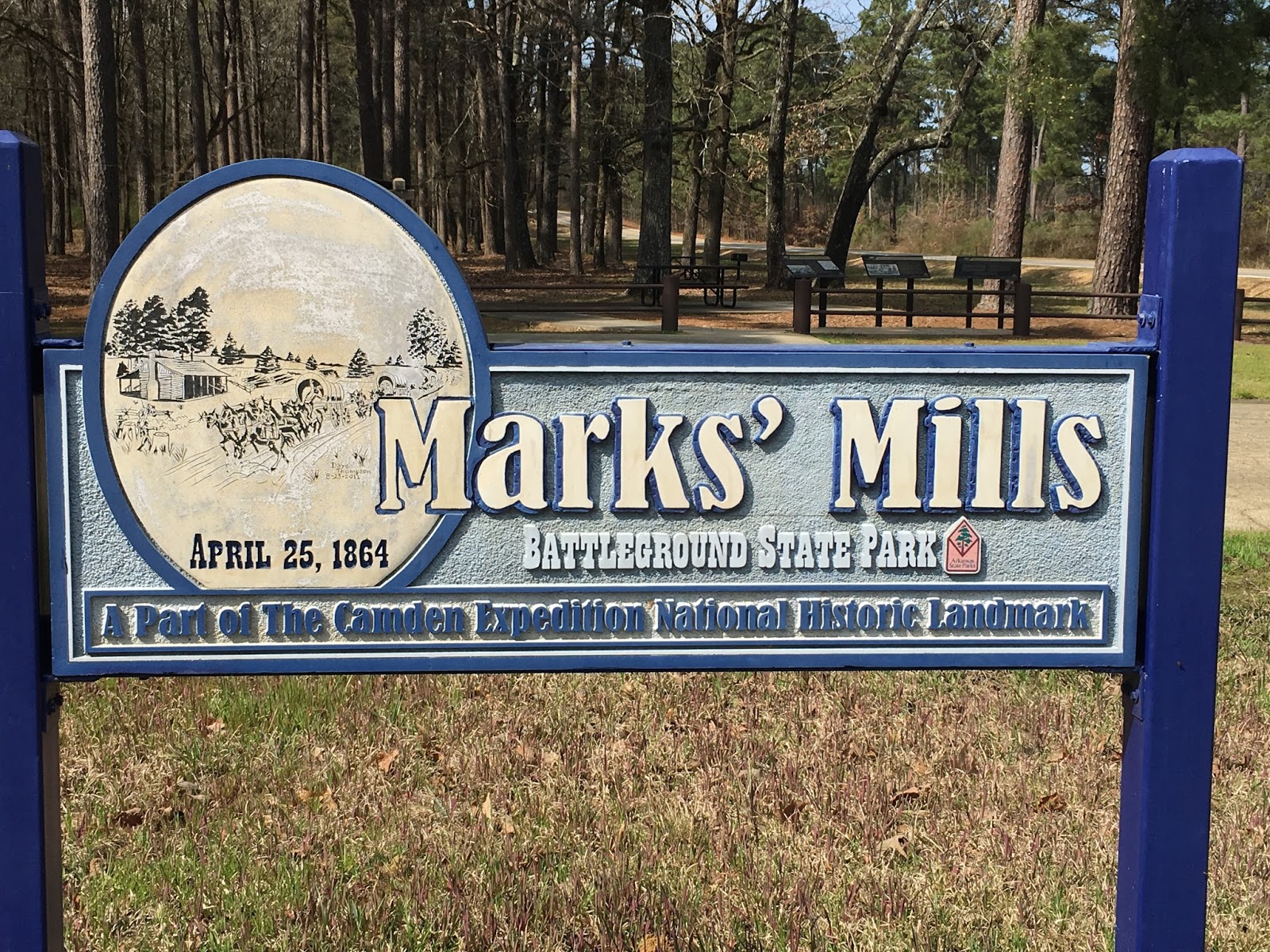
Next up was Poison Springs Battleground State Park, first in the Red River Campaign.  The cache was a good 100' away from where it was supposed to be and had recently been "cleaned up and fixed".  Unfortunately, the park series clues weren't put back, so I'm working on obtaining those from other sources.


Last stop of the day was our campground for the evening, White Oak Lake State Park.  Beautiful place to spend the evening (once the generator next door was turned off), nice trails to walk on, a lake to play on in warmer weather.  Unfortunately, this cache suffered from the same "clean up and fixup" as the last one, sigh.


Sunday morning we awoke to a nice foggy morning on the lake.  After breaking camp and eating breakfast we headed South East again to Millwood State Park.  This lake is the water source for Texarkana and home to lots of large bass (or so the brochure says).  We had an enjoyable stroll and picnic lunch on the two trails by the lake.


Historic Washington State Park was our next target.  Capital of Arkansas for a couple of years after the Union troops captured Little Rock.  A quaint little town.


A quick stop by Crater of Diamonds State Park to grab that cache and stickers for the kids' trunks.  The hiding spot for the cache was one of the more ingenious I've seen.


And then it was time to head the rest of the way home.

So, for the weekend that gives us:
#39 - Conway Cemetery
#40 - Logoly State Park
#41 - Poison Springs Battleground State Park
#42 - White Oak Lake State Park
#43 - Millwood State Park
#44 - Historic Washington State Park
#45 - Crater of Diamonds State Park

45 of 52, 87% getting close.  It was a successful set of Spring Break caching trips, 13 caches across the two weekends (still gotta track down the clues for 2 of those).


Monday, March 20, 2017

On the road again

It's Spring Break in Arkansas which must mean it's time to get back to geocaching.  This weekend took us to 6 parks via 450 miles or so of road.  For those who don't know, South Arkansas is timber country.  We saw LOTS and LOTS of timber.

The weekend started with a drive down to Cane Creek State Park.  After briefly confusing the ranger because "our name wasn't on his list" we got moved into our campsite for the weekend.  One thing we discovered is either there was a family reunion of sorts going on, or the folks around us knew each other from camping/fishing.

Saturday morning after packing a sack lunch we started our quest by obtaining the park's official cache.  We then headed off on a leisurely jaunt through the woods to one of the 3 swinging bridges in the park.  That was about a 6-7 mile stroll, the kids were pretty zonked by the time we finished.  We decided a drive in the car to another park to allow some rest time was in order.  So, we headed on over to Marks' Mills Battleground State Park (one of 3 stops on the Red River Campaign).  Oddly the park itself isn't where the skirmish occurred, that's a mile down the road, must have been where the state could get some land.  Once back home we road bikes for a while, working on a puzzle cache, we figured it out but never actually went to collect it, perhaps we'll be back some day.


Sunday morning we packed up and headed out on a rather circuitous route home.  Everyone heads out South to go North, right?  Our first stop was Moro Bay State Park.  When we arrived we were curious why the cabins were built up on stilts, then we found this pole.  Note that Emily's feet are about 20 feet above the current water level, that's a lot of water!  The kids had fun exploring the ferry that had crossed here until 1992.  And we learned that flammable and inflammable mean the same thing, who knew.


Next stop was the South Arkansas Arboretum State Park.  The azaleas were in bloom, though not much else was yet.  It was still a nice stroll.


Just down the road we stopped at the Arkansas Museum for Natural Resources.  Built near the crater of a sizable blowout it chronicles the rise and fall of the natural resources market in Arkansas.  Primarily timber and oil.


Turning north towards home we had one more stop to make, this time at Jenkins Ferry Battleground State Park.  The last stop on the Red River Campaign trail.  It was at this stop that the Union Army finally escaped the Confederate Army by destroying the temporary bridge across the flooded Red River.

So that gives us:
#33 - Cane Creek
#34 - Marks' Mills
#35 - Moro Bay
#36 - South Arkansas Arboretum
#37 - Arkansas Museum of Natural Resources
#38 - Jenkins Ferry

38 of 52, almost 3/4 (1 short)

Hopefully we'll be finished this fall.  Waiting until October for Queen Wilhelmina because of the migrating butterflies that stop by.